Original description by George Birch in 1894
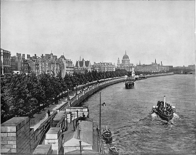
The Victoria Embankment extends along the left bank of the Thames, from Westminster Bridge to Blackfriars, a distance of nearly 1½ miles. It was constructed in 1864–70, under the superintendance of Sir Joseph Bazalgette, at a cost of about £2,000,000. It consists of a carriageway 64 ft. wide, and two foot pavements of 16 and 20 ft. in breadth respectively, the whole of which surface was, until construction of the Embankment, covered by the tide twice a day. On the river-side it is protected by a granite wall 8 ft. thick. The Embankment is lined with rows of trees, and pretty gardens have been made of some of the land reclaimed from the river. The principal approaches are from Blackfriars and Westminster Bridges, from Charing Cross, and from the Strand by means of several small streets.
Geolocation
From Waterloo Bridge, looking along the Victoria Embankment to Blackfriars Bridge. However, the bridge seen in the photo in the distance at right does not match either the old or the new Blackfriars Bridge. For a lot of information about Blackfriars Bridges see here.
The dark spire atop a triangular roof, seen to the right of St Paul's, is the City of London School.
The building running along the left edge of the photo from Waterloo Bridge should be Somerset House, but it may be that the crop just omits it.
Subject at centre of picture: TQ 311 808
Camera position: TQ 3070 8066
Camera height: on Waterloo Bridge
View direction: ENE
View angle: ° approx.
Focal length (35mm equiv):
Nearest similar geograph
Technical information
See here.